case-study-02
Red-Point: Climb with AR-Enhanced Route Navigation
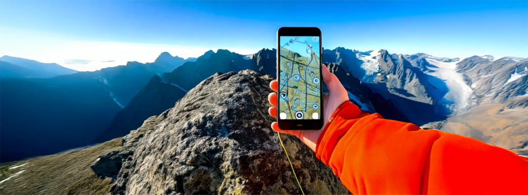
Red-Point is an AR app for climbers. It overlays route information onto mountain views using AR, showing details and difficulty levels. This makes climbing safer, planning easier, and helps climbers connect with each other.
Mountain climbers often faced significant challenges with outdated navigation tools that lacked real-time, interactive route information. Traditional maps and guidebooks made route planning and ensuring safety during ascents particularly difficult. To address these issues, Ariumsoft developed "Red-Point," a cross-platform application that uses augmented reality (AR) to overlay real-time route information directly onto mountains. This innovative app provides climbers with detailed route data, difficulty levels, and social connectivity features, enhancing their overall climbing experience. "Red-Point" leverages a range of advanced technologies, including Unity 3D, Autodesk Maya, NodeJS, MongoDB, Android Native, iOS Native, C#, Vuforia, Area Targets, and AR Foundation. These technologies enable the app to deliver a seamless and interactive experience for users. The app's real-time AR route visualization allows climbers to see their path overlaid on the actual mountain terrain, making navigation more intuitive and accurate. Detailed route information, including difficulty levels and potential hazards, helps climbers plan their ascents more effectively and ensures they are better prepared for the challenges ahead.
In addition to improving navigation and safety, "Red-Point" fosters a sense of community among climbers. The app's social connectivity features enable users to share their experiences, exchange tips, and connect with fellow climbers. This community engagement not only enhances the climbing experience but also promotes a culture of safety and mutual support. By providing real-time AR route visualization, detailed route information, and social connectivity, "Red-Point" significantly enhances the planning and safety of mountain climbs. Climbers can make more informed decisions, reduce risks, and enjoy a more connected and engaging climbing experience. This innovative solution demonstrates the potential of AR technology to transform traditional navigation tools and create a safer, more interactive environment for outdoor enthusiasts.

Moreover, "Red-Point" includes features such as weather updates and emergency alerts, which are crucial for climbers. Real-time weather updates help climbers prepare for sudden changes in weather conditions, while emergency alerts provide timely information about potential dangers, such as avalanches or rockfalls. These features further enhance the safety and preparedness of climbers. The app also supports offline functionality, allowing climbers to access route information and maps even in remote areas with no internet connectivity. This ensures that climbers are never left without crucial navigation tools, regardless of their location. Additionally, "Red-Point" offers personalized route recommendations based on the climber's skill level and preferences, making it suitable for both novice and experienced climbers. By integrating advanced AR technology with comprehensive route information and social connectivity, "Red-Point" sets a new standard for climbing navigation tools. This innovative app not only improves the safety and planning of mountain climbs but also fosters a connected and supportive climbing community. Ariumsoft's "Red-Point" is a testament to the transformative power of AR technology in enhancing outdoor adventures and ensuring climbers have the tools they need for a safe and enjoyable experience.


